Date of the walk - July 13 2014
You can download a two page summary of this walk by clicking here.
We decided to start our first walk at the beach directly south of all the boat harbours in South Fremantle – i.e. South Beach. Breakfast was at Aubergine Gourmet Foods, 231 South Terrace, South Fremantle, and then drove to the car park to between Marine Terrace and the railway, just south of Scott Street, to start our walk.
Figure 1 below shows the route we took showing each kilometre travelled, and Figure 2 shows the details of our walk (time, distance, average pace etc.).

Figure 1: The Route
Figure 1: Map showing the South Beach to Cockburn Marina walk

Figure 2: relevant data for the walk
Figure 2: Key information of the walk
This walk has four distinct sections:
- Start to the Pickled Fig Café – the path runs adjacent to a manicured grassed foreshore area with many recreation facilities;
- From the Pickled Fig Café to grassed CY O’Connor park – a winding and undulating bitumen coastal path through mostly native coastal vegetation;
- Sand track passed old power station to the marina – either a beach walk or a sand track; and
- Seawall walk – along the northern seawall of the Cockburn Marina.
From the carpark, we had to head north for about 100m to cross over the railway line at the entrance to the Fremantle Sailing Club. We then followed the path that runs parallel to the railway track (Plate 1) until we reached the main part of South Beach, where the South Beach café is located (Plate 2).

Plate 1: Start of the walk - path that runs parallel to the railway track. Carpark in the distance.

Plate 2: South Beach Cafe
The South beach carpark is a favourite place for campervan overnight stops (Plate 3).

Plate 3: Campervan in South Beach carpark
There is a toilet block just south of the café decorated with some impressive art (Plate 4).

Plate 4: Art work decorating the toilet block at South Beach.
Just ahead is the northern edge of a relatively new housing estate with multi-storey apartments located closest to the beach (Plate 5).

Plate 5: Multi-story apartments
The path continues to the west of the apartments, passed the Pickled Fig Café (Plate 6).
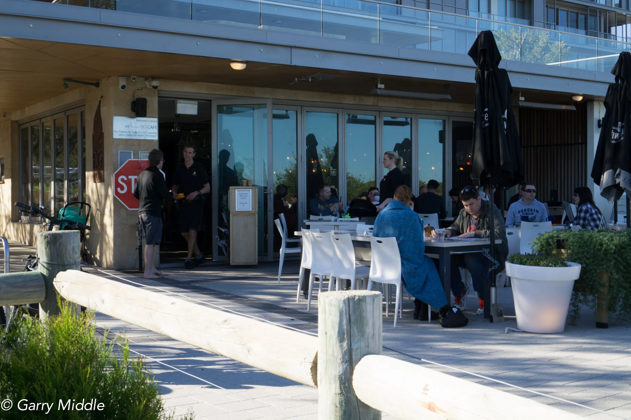
Plate 6: Pickled Fig Café.
From here, the coastal path proper begins, which is quite winding and undulating, and has views of the ocean from the high points. Most of the beach adjacent to this part of the path is a dog beach, and there are many people walking their dogs on the path as well as on the beach, not all of them on a lead (Plate 7). The path is also popular with cyclists.

Plate 7: Path south of South Beach, showing the ocean views.
It’s worth noting that in the warmer months, snakes are often seen crossing the path and there is a warning on the path to remind people of this (Plate 8).

Plate 8: Snake warning on the path
Along the way there are a couple of elevated sites with nice views over the ocean, where seats have been provided (Plate 9).
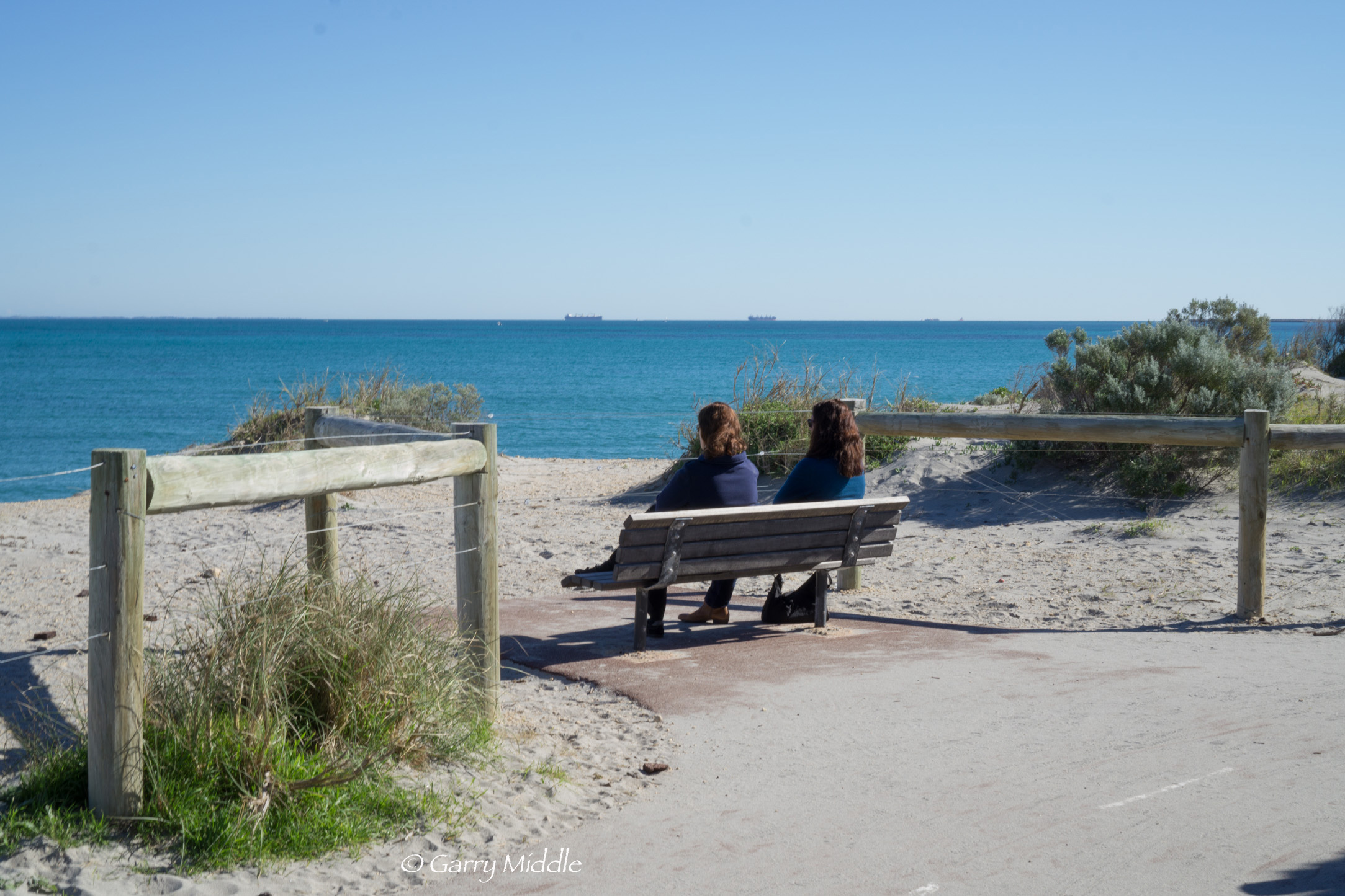
Plate 9: One of the seats where there are nice views over the ocean.
The land to the east of this section of the path is old and now rehabilitated industrial land. One of the main industries here was the Robb Jetty abattoir, and the remains of the jetty can still be seen on the beach at low tide (Plate 10) as well as the remains of an unknown shipwreck (Plate 11).

Plate 10: Old Robb Jetty at low tide

Plate 11: Unknown ship wreck at O’Connor Beach (part of the old Robb Jetty in the background)
Just off shore is a statue of a horse and horse rider, which celebrates the historic use of this section of the beach for horse training (Plate 12). The beach still gets regularly used by at least one horse trainer.
O'connor beach horse statue
Plate 12: Statue of a horse and horse rider at O’Connor Beach
On the path adjacent to the above there is some art that recognises the former abattoir (Plates 13 and 14).
Scott St Cockburn Marina-37
Scott St Cockburn Marina-39
Plates 13 & 14: Art adjacent to the path recognising the former abattoir at Robs Jetty
As we continued our walk, the old South Fremantle power station becomes the obvious landscape feature. Before we got there, there is a larger grassed area, carpark and toilet part of C Y O’Connor Park (Plate 15).
Scott St Cockburn Marina-48
Plate 15: C Y O’Connor Park
As we approached the park, we noticed a sandy track that went off to the right, so we took that track (Plate 16). This track goes to west of the park and the bitumen path goes through the park.
Scott St Cockburn Marina-126
Plate 16: Sandy track that goes around C Y O’Connor Park
The path effectively ends here, as the old power station and associated substation needs to be walked around (Plate 17). There is a path and old road that is to the east of the old power station and substation, but it is more interesting to take the sand track at the southern end of the carpark or walk on the beach towards the marina (Plate 18). We choose the sand track.
Scott St Cockburn Marina-51
Plate 17: View of old power station at the eastern end of the C Y O’Connor Park. This is also where the sand track starts. It either goes direct to the beach or veers left passed the power station.
Scott St Cockburn Marina-53
Plate 18: Sand track from end of carpark. Walk straight ahead for the beach of take the track to the left to walk passed the powered station
As we walked passed the power station we came across a pond, or water body, that seems to be an old cooling pond for the power station (Plate 19). Whilst there is no sign saying that the water quality in the pond is contaminated, it would be safest to walk around it. There is also an old jetty-like structure on the beach adjacent to the pond (Plate 20).
Scott St Cockburn Marina-61
Plate 19: Pond in front of the old power station
Scott St Cockburn Marina-109
Plate 20: Old jetty-like structure adjacent to power station
We decided to walk along the southern arm of the marina sea wall, and make this the turn around point. It easiest to climb the wall up passed the vegetation line, near where the sand track ends (Plate 21). There is a formal path and parks at the start of the wall (Plate 22), which then turns into a crushed limestone track.
South Beach to Cockburn Marina-40 merged
Plate 21: A poor ‘stitch’ of two photos showing where to climb the marina wall up passed the vegetation line.
South Beach to Cockburn Marina-41 copy
Plate 22: The park adjacent to the path near the start of the sea wall.
The wall is popular for fishing (Plate 23). There are many vacant blocks in the marina, but less so in the land-backed part of the marina, and there doesn’t seem to be any vacant boat pens. (Plate 24)
South Beach to Cockburn Marina-25
Plate 23: Fishing off the marina wall.
South Beach to Cockburn Marina-42
Plate 24: View of boats pens and land-back part of Cockburn Marina
We ended our walk at southern tip of this seawall (Plate 25), where we had morning tea before heading back
South Beach to Cockburn Marina-27
Plate 25: Morning tea at out turn-around point – at the end of the Cockburn marina northern sea wall.